The Capital Ring Walk consists of fifteen segments that completely encircle London. The total distance is about 125 km, with each segment consisting of from 7 or 8 km to 15 km or so, easily manageable in two or three hours. The start and finish of the segments coincide with Underground or rail stations. Maps and guides for each segment are available here.

We will organise this as a group, walking every two or three Sundays, weather permitting, with an 11 AM start, and either conclude with a lunch somewhere at the end of the walk, or stop along the way. Perhaps in the warmer months we can plan on a picnic.

We will not walk in the rain, or if there is a strong likelihood of rain or similar foul weather.

Participants are encouraged to make comments and post photographs. If a walk is to be postponed because of bad weather, this will be announced on the blog a few hours before the start.

17 February 2013

Wimbledon Park to Richmond

-->
Daria, Penelope and Nadia at the entrance to Wimbledon Park.
Roughly a year since we started our walks, we headed off today on the eleventh segment of the Capital Ring. It was a gorgeous early spring day, with the sun shining and nice signs of the future, like bulbs starting to bloom. We were joined today by Daria Sartori, who is visiting Middlesex University School of Law as part of her research for a doctorate at the University of Trento, in Italy. It was a long walk - probably 12 km altogether. For part of it, we were accompanied by runners who were doing a 50-km circuit through London. Occasionally we had to help them with directions - some of them must have run more than 50 km because they took some wrong turns.
The route began at Wimbledon Park Underground Station. Soon we were in Wimbledon Park, from where we could see the famous All England Lawn Tennis and Croquet Club. Wimbledon Park is said to date to the 16th century, when it was part of the Wimbledon Manor House. The Park was used for deer hunting and hawking.
The windmill in Wimbledon Common.
The trail crosses the Park and then continues to Wimbledon Common, one of many ‘commons’ that we have crossed as we have walked through South London. In the middle of the park is the Wimbledon Windmill, a very distinctive landmark to which is attached a museum (www.wimbledonwindmill.org.uk). Next to the Windmilll is the London Scottish Golf Course, with its distinctive clubhouse. There are many lakes along this route too. At the windmill we met four other walkers who were also following the Capital Ring. It is only the second time in all of the walks that we have met another Capital Ring walker.
Wimbledon Common, with windmill.
Bench in Wimbledon Common, with recent bouquet of flowers in honour of Peter Smith.
The really glory of the walk was passing through Richmond Park, which has herds of deer – we saw scores of deer, although at a distance – and vast open spaces unlike anything I have ever seen in a large city like London. The path was often muddy and difficult, and were we to do it again we probably would have worn Wellies. Not far from the herd of dear was an attractive old building, dating to the early eighteenth century, which is now the home of the Royal Ballet School. Apparently the building is featured in the film Billy Elliot.
We stopped for a late lunch at Pembroke Lodge, which sits atop a ridge overlooking the Thames Valley. The view was quite spectacular. The Lodge was the residence of Prime Minister Lord John Russell in the mid-nineteenth century and was the childhood home of Bertrand Russell.
Scene in Richmond Park.
There is a marvellous belvedere next to the Lodge where one can see St. Paul’s Cathedral with a telescope, as well as Heathrow Airport, Windsor Castle and Runneymede Island (where the Magna Carta was proclaimed). The telescope is atop Henry’s Mound. According to legend, Henry VIII stood here in 1536 waiting for a flare that would tell him that Anne Boleyn had been executed and he was free to marry Jane Seymour.
View of Thames Valley from Henry's Mound.
We walked down the large hill to Petersham Gate, where one exits Richmond Park. The Park is surrounded by a brick wall more than 2 metres high, and its circumference is apparently almost 13 km.
-->
Richmond Bridge.
The path goes through some alleyways in the village and then opens out onto the Thames River. There are a few longboats and some yachts. In the distance is Richmond Bridge. Soon it becomes very fashionable and gentrified. Just next to Richmond Bridge is a statue honouring Bernardo O'Higgins, who was a great Chilean patriot of Irish origin.
Statute of Bernardo O'Higgins.
We have finished our long pilgrimage through south London which began many months earlier at Woolwich Foot Tunnel. 
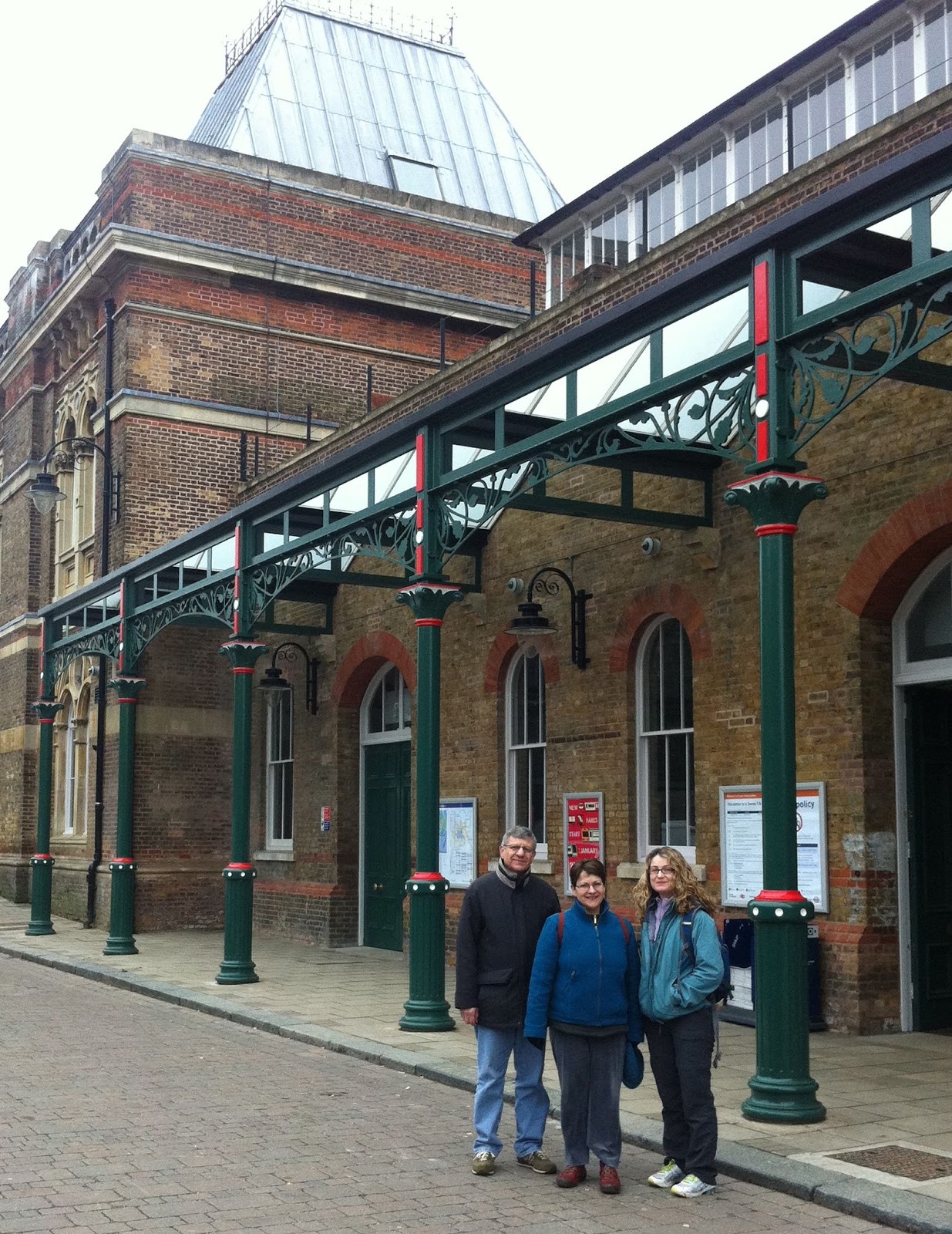
Richmond Station.

In three weeks, we meet again at Richmond and head into northwest London for the final four segments of the Capital Ring. 

27 January 2013

Streatham to Wimbledon


Nadia Bernaz and Margaret Schabas at Streatham Common Rail Station.

Streatham Pumping Station.


The weather in London has been cold and snowy of late, but everything seemed to clear by mid-morning and we walked under blue skies from Streatham to Wimbledon in south London.
Shortly after leaving Streatham Common train station, we passed by the Streatham Pumping Station, a very exotic looking building that dates to 1888. The route continues to Tooting Bec, where it passes by the Tooting Bec Lido, said to be one of the largest swimming pools in Europe, holding a million gallons of water. We walked through Tooting Bec Common and then towards Balham.
At the Tooting Bec Lido.
From there, the route goes to Wandsworth and the Wandsworth Common. It also proceeds beside the Wandsworth Prison.
Wandsworth Prison was built in 1851. Oscar Wilde was imprisoned there in 1895 before being moved to Reading Gaol. It was also the site where Derek Bentley was hanged in 1953, one of the last executions in the United Kingdom. Bentley’s conviction was overturned by the courts in 1998.
Wandsworth Prison, where Oscar Wilde was incarcerated.
Magdalen Road runs alongside a cemetery. The guide invited us to walk through the cemetery, where we found a small section with war graves of Australians. One of them belonged to a ‘Private Ryan’. Most of the deaths were in late 1915, presumably associated with the battles at Galipoli.
Grave of Private Ryan.
The route crosses over the River Wandle and then to Wimbledon, where this section of the Capital Ring concludes.

02 January 2013

Crystal Palace to Streatham Common

Departing from Crystal Palace rail station.
Our first walk of the year took place on a rather dreary day, and a slight drizzle began just as we were nearing the end of the route, at Streatham rail station. Penelope, Nadia and I were joined by Penelope's brother Sotos Soteriou, who is visiting from Toronto.
To be fair, this was not the most interesting of the segments of the Capital Ring. There were some pleasant parks and some rather dramatic views, but very little of cultural interest. Some parts of the route are more stimulating than others, I suppose.
The route begins at the Crystal Palace rail station. It winds through a residential neighbourhood, then traverses the Westow Park, followed by Upper Norwood Recreation Ground and Biggin Hill Wood.
Norwood Grove.
An 'alternate route for dog walkers'!
The highlight of the walk starts when the trail enters Norwood Grove, which is a remnant of the Great North Wood. There is an impressive building atop the hill, built in the 1840s by Arthur Anderson, joint founder of the P & O Steam Navigation Company. It is now an education centre owned by Croydon Council, and is much in need of a coat of paint and some repairs.


War memorial at Streatham.
This is really the beginning of Streatham Common, or so it seems. The path enters the Rookery Gardens, which are very beautiful, and then proceeds to the huge, open expanse of Streatham Common.

25 November 2012

Grove Park to Crystal Palace


Today we passed the half-way point on the Capital Ring, completing the eighth segment (out of fifteen). We started early in the year at Hendon Central, roughly at 12 o’clock on the dial, and finished today at Crystal Palace, roughly at 6 o’clock. There were some beautiful parts of the walk, especially through the Beckenham Place Park, but not as much in terms of cultural highlights as on previous walks. There were also some lovely views of the London skyline. This was probably the longest walk we have done, more than 8 miles (or 13 km) in length. The weather was very pleasant, apparently an interlude in what has been a very stormy time here in England.
Entrance to Beckenham Place Park.
From Grove Park, the route proceeds through a park and some residential neighbourhoods until it enters Beckenham Place Park, which appears to be about 1 square km in size. There is a footbridge over the Ravensbourne River and then a lovely part that goes through a wooded area.

But can you have five cats?

Muddy stretch in the Beckenham Place Park.


View of the golf course, with the mansion in the distance.


Front garden in Penge looks like a greenhouse that collapsed.


Telecommunications tower at Crystal Palace.
The path opens up on a golf course, which takes up perhaps one-third of the park. Atop a hill overlooking the gold course in an old mansion. The mansion was linked to the Cator family, who build it in the late 18th and early 19th century. It boasts a number of distinguished visitors, including Samuel Johnson, the botanist Linnaeus and the actor David Garrick.
Dinosaurs in the Crystal Palace Park.
Then the path continues through residential areas until it reaches the town of Penge, which is the gateway to the Crystal Palace. Crystal Palace Park is quite developed, with a huge sports centre, a number of rather odd dinosaur statues, and the BBC tower. The Capital Ring guide claims it to be the tallest structure in London, at 900 ft. But it must be out of date, because the Shard is slightly over 1,000 ft (or 300 m), and claims the distinction of being the tallest building in all of Europe.

24 September 2012

Falconwood to Grove Park


Departing from Falconwood: Nadia, Delfin, Penelope, Radha, Elvira and Joshua.
We almost didn’t do the walk on this first day of autumn. There were serious weather warnings, but we thought we’d take a chance. By the time we got to London Bridge train station, on the way to Falconwood, people had their umbrellas out. Elvira arrived to join us at London Bridge after running a 10k race!
By the time we got to Falconwood Station (where we stopped on the previous walk), it was what we would call in the west of Ireland a ‘soft day’, and so we decided to head out.
This was the biggest group yet, because Joshua Castellino and Elvira Dominguez and their two children, Radha and Delfin, joined us. And a little later, en route, we were met by Eadaoin and Tom, so we were nine.
At full strength, with Eadaoin and Tom.
We walked through Eltham Park and surroundings for about 2 km until we met up with Eadaoin and Tom. One of Eltham’s claims to fame is being the birthplace of Bob Hope!
On one of the trails there was a hollow oak, a bit of a landmark, and Delfin crawled into it. There is an interesting old building called Conduit Head which was the original water supply for nearby Eltham Palace.
Delfin in the hollow oak.
Indeed, it was Eltham Palace that was the highlight of this walk. We weren't allowed to take photographs, but there are loads on the Palace website.
Built many hundreds of years ago, it was used by Royals for centuries before being trashed during the revolution in the 17th century.  It was used as a farm, and barely saved from total destruction.
Then, in the early century it was obtained by the wealthy Courtauld family, who built a gorgeous art deco mansion on the land. The surviving part of the palace is the magnificent great hall, which adjoins the more modern building.
We planned to stop there only for a bit of lunch, but when we finished our meal it was pouring outside and so we decided to visit the palace. Beautiful and quite eccentric, it is in marvelous condition, having been restored a decade or so ago by the English Heritage.
Penelope, on the bridge to the palace.
It felt as if one of the Agatha Christie shows had been filmed here. And sure enough, several of them were in fact set in the palace. Nadia found a tour of the palace on the internet, narrated by David Suchet.
We hesitated about continuing with the walk, because although the rain had subsided somewhat, it was still rather wet. Finally, though, we decided to go ahead, and we didn’t regret it. The route follows by several stables. At one point there is a fabulous view of the London skyline. It was misty and grey, but the beautiful new Shard poked up into the skies.
Grove Park train station, wet and weary.
Joshua got a bit of a thrill as we passed the home of T.G. Grace, a famous cricketer (none of the rest of us had ever heard of him).
The route ends at Grove Park Station. We were all a bit damp, but none the worse for wear, and headed home on the train and the tube. On our next walk we will cross the meridian in south London and proceed to the Crystal Palace. We’ve done seven of the fifteen walks now.
It's great fun, even in the rain!

02 September 2012

Woolwich to Falconwood


After a summer recess, today we resumed our walks around London. We started where we had left off in May, at Woolwich Arsenal station. It is on the south side of the Thames. This is where we crossed the river on our last walk, through the pedestrian tunnel. There was lots going on in Woolwich today because events of the Paralympics are being held nearby.
Woolwich Market, but closed today
We walked along the river in the direction of the centre of London for perhaps a kilometer, up to the flood barrier. Then we headed more or less due south. I’d been warned that this would be pretty dull going, with little of cultural interest and nowhere interesting to stop for a drink or a bite to eat. 
How wrong that advice was! We walked for about 10 km, essentially through continuous parkland. It was gorgeous. There were a few dog walkers but little in the way of crowds. The scenery was varied, with beautiful trees and wildflowers, a few historic old buildings, and some delightful places to stop for coffee and a bite to eat.
Four dogs per walker
Visiting mother goose
From the Thames, the path goes into Maryon Park and then to Maryon Wilson Park. These parks were apparently formed from sandpits, which provided the floors for London kitchens a few centuries ago. There is a children’s zoo which is very charming.
Old Cottage Coffee Shop near Charlton House
The route proceeds to Charlton House, built in 1612 and said to be one of the best examples of Jacobean architecture left in London. We didn’t stop at the House, but in the park where it is located is a lovely café. They were serving salt beef sandwiches, and I was certainly tempted, but satisfied myself with an espresso and a glance at the Sunday papers. There was a cricket match going on in the park that we watched while we had our coffee.
Then the trail crosses the Woolwich Commons, where we saw a field full of wild sweet peas. Then it works its way to Shooters Hill. There is quite a climb. Shooters Hill is mentioned in Dickens’ A Tale of Two Cities, where he speaks of coaches lumbering up the road. It is also referred to in Pickwick Papers. Apparently it was a favorite lair of highwaymen. Pepys refers to gibbets of those who were caught.
Severndroog Castle
From there, the path goes to the Oxleas Woodlands, climbing again to a high point of land where Severndroog Castle is located. The castle is boarded shut, but it still makes an impressive site. It was built as a memorial to Commodore Sir William James, who captured a fortress in India on the Malabar coast in a campaign against piracy. I expect that the Indians have another version of this story.
Nadia and Penelope relaxing near the rose garden
From the castle, the path goes down some rugged steps to a rose garden, part of which is rather neglected and part maintained and very lovely. Then it leads to the Oxleas Meadows where there is a café atop the hill. It has a fabulous view to the south. The food was just good enough – omelets, beans and chips, that sort of thing – but the setting made up for this. I was reminded of the joy of these walks, which involve discovering places in London we would never know otherwise. I expect that few people from outside the immediate neighbourhood know of this place to have brunch on Sunday.
View from the cafe where we had lunch.
Then, it is a short walk through the Shepherdleas Woods and on to Falconwood Railway Station, from where we headed home.
A great day out in weather that was warm, cloudy and fairly humid, but with no rain. We’ll be back walking in a few weeks. Feel free to join us.

28 May 2012

Royal Albert Dock to Woolwich

Nadia and Penelope at Cyprus Place, near the DLR station.
We had a gorgeous, warm summer day for yesterday’s walk around London, in rather abrupt contrast with the weather on the previous walk. This is segment 15 of the Capital Ring, and for those who started at segment 1 (we did not) it is the end. This is the farthest east that the trail gets. The entire walk skirts the river and, at the end, crosses it.
Cyprus DLR station
We met up at Royal Albert Station on the Docklands Light Railway. The train was filled with weird people dressed in strange costumes, not something that one usually finds on public transportation in London on a Sunday morning. They were all going to some comic book costume ball at the ExCel Centre, which is very near London City Airport.
The walk proceeds through Beckton District Park and to the next station on the DLR, which is called ‘Cyprus’. It is named after an estate called Cyprus that was once located there and that was, in turn, named after the Mediterranean island that Britain colonized in 1878. From the station one enters the very nice, modern campus of the University of East London. We were particularly struck by the student residences, which are colourful, cylindrical buildings offering fabulous views of the Thames and of east London. The tall buildings of Canary Wharf are in the distance.
View from the University of East London.
Rowing in the Dock.
This is the Royal Albert Dock, which closed in 1981 after operating for about a century. Ships entered the dock from a lock on the river. It must once have been lined with warehouses and various shipping establishments, but all that remains now is the pretty campus. The dock itself is now used as a place for rowing. The Olympic events will take place here.
Student residences at University of East London.
Poppies.
Rather dodgy pathway near the Lock.
The path continues through a rather dull field and then doubles back to the river. We crossed the lock gates, which are quite tall and dramatic. Then there are several modern apartment buildings and an attractive park, which was filled with people sunbathing and having picnics.
The end of the walk is the Woolwich foot tunnel. The lifts are being repaired, so we had to do the 100 steps down and up again. At Woolwich we wanted to have a drink and something to eat, but there really wasn’t any place decent, so we took the DLR and the Tube to London Bridge and went to a great tapas joint.
On our next walk, in a few weeks, we will start exploring South London.
Crossing the Lock.
Walking through the Woolwich Foot Tunnel.
View from the south bank of the River looking West.
.