The Capital Ring Walk consists of fifteen segments that completely encircle London. The total distance is about 125 km, with each segment consisting of from 7 or 8 km to 15 km or so, easily manageable in two or three hours. The start and finish of the segments coincide with Underground or rail stations. Maps and guides for each segment are available here.

We will organise this as a group, walking every two or three Sundays, weather permitting, with an 11 AM start, and either conclude with a lunch somewhere at the end of the walk, or stop along the way. Perhaps in the warmer months we can plan on a picnic.

We will not walk in the rain, or if there is a strong likelihood of rain or similar foul weather.

Participants are encouraged to make comments and post photographs. If a walk is to be postponed because of bad weather, this will be announced on the blog a few hours before the start.

04 November 2013

Sudbury Hill to Hendon Central


Hendon Central. The End.
We did it! We finished the 15 segments of the Capital Ring yesterday, on a blustery, chilly autumn day. Besides Nadia Bernaz and Penelope Soteriou, who have done the whole route, we were joined by Oscar Sotiriou (visiting us from Murcia, in Spain) and Joseph Mugalula (a new doctoral student at Middlesex University). It was the longest walk – about 17 km – because we had only managed to do half of the previous segment.

Entering Harrow on the Hill
Playing fields of Harrow


Harrow School


South Kenton Station


Stile at Harrow


Starting out in Sudbury Hill
Starting from in west London we walked for about  1km to Harrow-on-the-Hill, the lovely town that houses the famous Harrow School, which is apparently – in the 21st century – still boys only. Harrow School was established in 1572 by John Lyons, a local farmer and landowner. Its distinguished former students include Winston Churchill, Pandit Nehru, Lord Byron, Richard Brinsley Sheridan and Anthony Trollope. Lord Byron was at Harrow School as a boy and his little daughter Allegra (by Clair Clairmont) is buried in an unmarked grave outside St Mary’s Church, very near to the south porch; a plaque commemorates the place.
Swan in the Reservoir
After passing through the town on the hill, with the very attractive school buildings, we walked down Football Lane to the school’s enormous playing fields. Then the path goes through a wood and between the Northwick Park Hospital and a golf course, ending at South Kenton Underground Station. This is the end of segment 9 of the Capital Ring. We stopped there at the Windermere pub for a break. It is apparently listed in the National Inventory of the Campaign for Real Ale, because of its typical 1930s decor. I wouldn’t suggest anybody go out of their way to find it unless you are really an enthusiast for 1930s pub décor.
Panorama from Barn Hill
Barn HIll with 'trig point' and Wembley Stadium in the distance
From there the route winds through a pleasant residential neighbourhood and into the Fryent Country Park. At the top of Barn Hill (86m) there is a great view of London. There is also a ‘trig’ point, originally used in mapping the land. A few km further on is another very scenic hill known as Gotfords Hill. The route proceeds through Church Lane where there is the very pretty St Andrews Church with an old and rather abandoned graveyard.
St Andrews Church
Welsh Harp Reservoir
Then it proceeds to the Welsh Harp Reservoir. I’d seen it before, but only at a great distance, from the North Circular Road. The Capital Ring takes you on the north side of the reservoir, where there is plenty of wildlife and a sailing club.
At the end of the reservoir, it is a short walk through West Hendon and on to Hendon Central Underground Station, where we started this 125km circuit of London in February 2012.
Almost at Hendon
The fifteen Sundays we have spent walking around London have introduced us to parts of the city that we might never have seen. Much of it was in parkland. It is quite stunning how many green spaces are to be found in London. Although it is very well waymarked, and there are great explanatory guides to the segments of the Capital Ring on the internet, we only rarely met other people who were doing the walk.
Now we will start exploring the English countryside around London. But that’s for another blog. With this, I sign out.

08 September 2013

Greenford to South Kenton

The entrance to the wetlands.
Bridge over the Grand Canal.
For the first time on our walks around London, we got rained out. We only finished half the walk. We’ll pick up where we left off on the next – and final – segment of the Capital Ring.
It looked like a beautiful early autumn day, without a cloud in the sky, when we started this morning. There was quite a shlep to Greenford Station because of Sunday closures of some of the underground lines.

Canal boats.


From Greenford Station the route enters the Paradise Fields Wetlands and for more than a kilometer we walked along the towpath of the Grand Union Canal. Then we entered the Horsenden Hill Visitor Centre which is a cluster of old farm buildings.
The path climbs Horsenden Hill, where there are quite spectacular views of much of north and west London. The guide to the Capital Ring describes it as follows:


Horsenden Hill at around 275 feet (84m) provides one of the finest natural viewpoints in London and is a popular kite-flying spot. On a clear day, looking west, you can see the Chiltern Hills, while to the north lies Harrow-on-the-Hill with the spire of St. Mary’s Church. During World War I, the summit came to the fore with the siteing of an anti-aircraft gun pulled by a horse – a defence against German airships. 2,500 years ago, Iron Age people settled on Horsenden Hill leaving behind large amounts of pottery. The Iron Age settlement is now a Scheduled Ancient monument.
A major change in the area occurred in the 1800s with the opening of the Paddington arm of the Grand Junction Canal. This enabled hay, the area’s main product, to be shipped into London in great bulk and in return London sent Horsenden ‘Mack’ – an unpleasant mix of street sweepings, fish and meat offal and horse droppings – to be used as manure for the fields.
Going down the hill just before the rain began.
When we got down the hill, there was some sprinkling and soon a real shower. We made it to a bus shelter but we are already fairly wet and decided to return home. We finished at Sudbury Town underground station. It seems there is about 4-5 km remaining on the segment, which we’ll add to the 9 km for the final part of the Ring when we resume in a few weeks.

30 June 2013

Osterly Lock to Greenford


Penelope and myself at the start of the walk.
On a beautiful summer’s day – the first and, we fear, the last – we walked the segment of the Capital Ring from Osterly Lock to Greenford in the western part of London. It is the thirteenth segment we have walked, and only two now remain until we finish the entire circuit.


Nadia and Penelope at Osterly Lock.


The walk is very beautiful and almost all of it is in parkland. Much of the early part of the walk follows the Grand Union Canal towpath. The Grand Union Canal links London with Birmingham, a distance of 145 miles (232km). It opened in 1805 as the Grand Junction Canal, but gained its present name after a merger in 1929 with other waterways.
One of the bridges over the Brent River.
The walk begins at Osterly lock, which is the first of what is called the Hanwell flight, comprising six locks which change the level of the water by 16m. The path comes to the Hanwell Bridge where there has been a bridge since the 14th century. The bridge today dates from 1762.
Wharncliffe Viaduct.
The path opens into a huge meadow where the Wharncliffe Viaduct is in the distance. It was built in 1838 by lsambard Kingdom Brunel, the great Victorian engineer. According to the guide, Brunel built it for the Great Western Railway from London to Bristol. The viaduct is named for Lord Wharncliffe and it bears his coat of arms can be seen at the centre of the span.
The route then follows through a series of parks until it reaches the A40 (Western Avenue) where there is a footbridge. From there, most of the remainder is on footpaths in a residential neighbourhood. The segment ends at Greenford Road, passing under two bridges, one for the rail lines and the other for the Central Line.
Crossing the A40.
Aside from the viaduct, there was not a great deal of cultural interest on this walk. But the scenery was really lovely and everything was enhanced by the wonderful weather.
We’ll take a break now until the end of the summer because we cannot find a convenient weekend for the next walk. The final walks will take place in the early autumn at dates to be announced.

10 March 2013

Richmond Bridge to Osterly Lock

Daffodils in Richmond

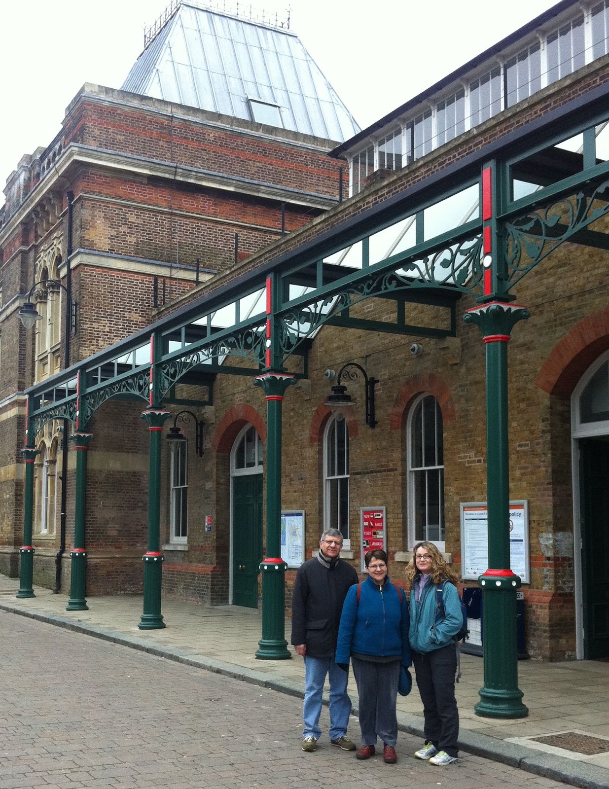
Starting in coffee shop at Richmond train station.

Quaint tower in Richmond.


There were a few snowflakes in the air and it was quite cold as we set off on the twelfth of our segments of the Capital Ring walk around London. There are three more segments to go until we finish. Today we were joined by my brother, Michael Schabas, and my sister-in-law, Veronica Lam.
Start of Thames towpath.
Today’s walk was from Richmond Bridge, at the farthest west point on the circuit. It is the point where we cross the Thames. We did this many months ago at the easternmost point, and our last seven walks have taken us through south London.
The path begins at Richmond rail station. The town itself, which sits beside the river, is lovely and quite chic, with fancy boutiques and beautiful homes. Despite the wintry feel because of the cold weather, the city looks like it is spring, and the daffodils and blossoms are starting to come out.
Over the bridge, to north bank of Thames.
We walked along the towpath beside the Thames for a fair distance, passing under the Twickenham Railway Bridge. To the right is the Old Deer Park, which further on joins Kew Gardens. The Old Deer Park is used used for sport and recreation but was originally a Royal Hunting Park of around 370 acres, created by King James I in 1604.The towpath is on a raised causeway that was built in the river itself in 1766. There are some obelisks which were erected in 1778 to mark the Meridian before it was moved to Greenwich.
Obelisk in Deer Park marks old Meridian.
At Richmond Lock we crossed the river. Very high tides were expected today, and we might have been wading through water had we come here a couple of hours later. The path follows the river and then it leaves the Thames and heads north.
We passed the London Apprentice pub which dates from Tudor times. By tradition City apprentices would be rowed with their senior craftsmen to this famous inn to celebrate the receipt of their indentures, entitling them to full journeymen’s wages.
The London Apprentice.
Then the path continues to Syon Park, which is a huge estate belonging to the Duke of Northumberland. There is what looks to be a gorgeous mansion, but it was closed for visits. There is also a lovely garden centre, and we stopped there for a cup of tea.
At Syon Park there is a plaque commemorating Richard Reynolds, who was the chaplain of Syon Monastery in the 16th century who managed to get his head chopped off by Henry VIII.
Lock on the Grand Union Canal.
Start of the Canal at Brentford Lock.
The path continues to Brentford Lock, which is towards the end of the Grand Union Canal. It turns north and follows the Canal for several miles. At the start, there is a big basin, with new housing. Twenty or thirty years ago, it was lined with warehouses, but only one remains.
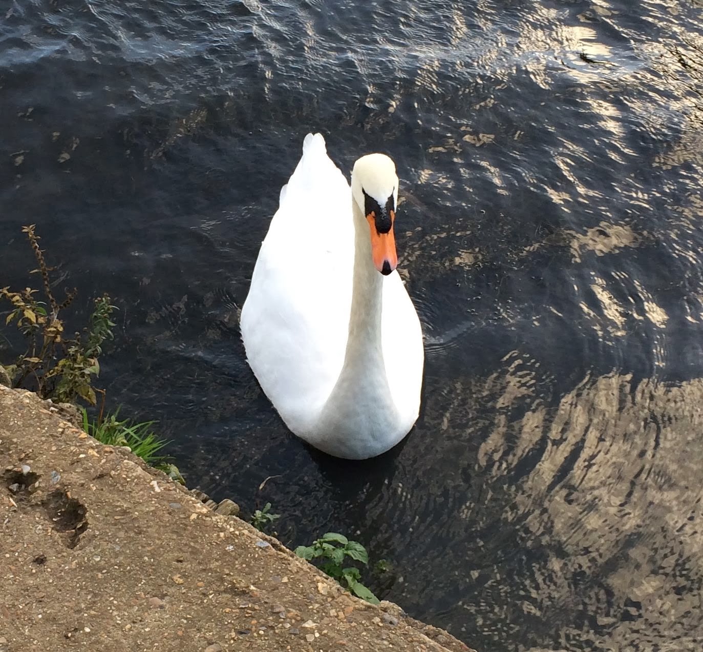
We continued along the towpath, passing under the major roads that head west to Heathrow Airport and beyond. The Canal is quite lovely, and there was a lot of wildlife: swans, mallards, geese and so on.
Boston Manor Underground station.
We saw lovely pubs in Richmond and around the river, but Boston Manor, at the end of the walk,  was a bit desolate and the only places to eat around the Underground stations were Chinese takeaways. So we took the Underground to King’s Cross where we had a great lunch in the Parcel Yard, which is a great pub and restaurant atop the train station.

17 February 2013

Wimbledon Park to Richmond

-->
Daria, Penelope and Nadia at the entrance to Wimbledon Park.
Roughly a year since we started our walks, we headed off today on the eleventh segment of the Capital Ring. It was a gorgeous early spring day, with the sun shining and nice signs of the future, like bulbs starting to bloom. We were joined today by Daria Sartori, who is visiting Middlesex University School of Law as part of her research for a doctorate at the University of Trento, in Italy. It was a long walk - probably 12 km altogether. For part of it, we were accompanied by runners who were doing a 50-km circuit through London. Occasionally we had to help them with directions - some of them must have run more than 50 km because they took some wrong turns.
The route began at Wimbledon Park Underground Station. Soon we were in Wimbledon Park, from where we could see the famous All England Lawn Tennis and Croquet Club. Wimbledon Park is said to date to the 16th century, when it was part of the Wimbledon Manor House. The Park was used for deer hunting and hawking.
The windmill in Wimbledon Common.
The trail crosses the Park and then continues to Wimbledon Common, one of many ‘commons’ that we have crossed as we have walked through South London. In the middle of the park is the Wimbledon Windmill, a very distinctive landmark to which is attached a museum (www.wimbledonwindmill.org.uk). Next to the Windmilll is the London Scottish Golf Course, with its distinctive clubhouse. There are many lakes along this route too. At the windmill we met four other walkers who were also following the Capital Ring. It is only the second time in all of the walks that we have met another Capital Ring walker.
Wimbledon Common, with windmill.
Bench in Wimbledon Common, with recent bouquet of flowers in honour of Peter Smith.
The really glory of the walk was passing through Richmond Park, which has herds of deer – we saw scores of deer, although at a distance – and vast open spaces unlike anything I have ever seen in a large city like London. The path was often muddy and difficult, and were we to do it again we probably would have worn Wellies. Not far from the herd of dear was an attractive old building, dating to the early eighteenth century, which is now the home of the Royal Ballet School. Apparently the building is featured in the film Billy Elliot.
We stopped for a late lunch at Pembroke Lodge, which sits atop a ridge overlooking the Thames Valley. The view was quite spectacular. The Lodge was the residence of Prime Minister Lord John Russell in the mid-nineteenth century and was the childhood home of Bertrand Russell.
Scene in Richmond Park.
There is a marvellous belvedere next to the Lodge where one can see St. Paul’s Cathedral with a telescope, as well as Heathrow Airport, Windsor Castle and Runneymede Island (where the Magna Carta was proclaimed). The telescope is atop Henry’s Mound. According to legend, Henry VIII stood here in 1536 waiting for a flare that would tell him that Anne Boleyn had been executed and he was free to marry Jane Seymour.
View of Thames Valley from Henry's Mound.
We walked down the large hill to Petersham Gate, where one exits Richmond Park. The Park is surrounded by a brick wall more than 2 metres high, and its circumference is apparently almost 13 km.
-->
Richmond Bridge.
The path goes through some alleyways in the village and then opens out onto the Thames River. There are a few longboats and some yachts. In the distance is Richmond Bridge. Soon it becomes very fashionable and gentrified. Just next to Richmond Bridge is a statue honouring Bernardo O'Higgins, who was a great Chilean patriot of Irish origin.
Statute of Bernardo O'Higgins.
We have finished our long pilgrimage through south London which began many months earlier at Woolwich Foot Tunnel. 

Richmond Station.

In three weeks, we meet again at Richmond and head into northwest London for the final four segments of the Capital Ring. 

27 January 2013

Streatham to Wimbledon


Nadia Bernaz and Margaret Schabas at Streatham Common Rail Station.

Streatham Pumping Station.


The weather in London has been cold and snowy of late, but everything seemed to clear by mid-morning and we walked under blue skies from Streatham to Wimbledon in south London.
Shortly after leaving Streatham Common train station, we passed by the Streatham Pumping Station, a very exotic looking building that dates to 1888. The route continues to Tooting Bec, where it passes by the Tooting Bec Lido, said to be one of the largest swimming pools in Europe, holding a million gallons of water. We walked through Tooting Bec Common and then towards Balham.
At the Tooting Bec Lido.
From there, the route goes to Wandsworth and the Wandsworth Common. It also proceeds beside the Wandsworth Prison.
Wandsworth Prison was built in 1851. Oscar Wilde was imprisoned there in 1895 before being moved to Reading Gaol. It was also the site where Derek Bentley was hanged in 1953, one of the last executions in the United Kingdom. Bentley’s conviction was overturned by the courts in 1998.
Wandsworth Prison, where Oscar Wilde was incarcerated.
Magdalen Road runs alongside a cemetery. The guide invited us to walk through the cemetery, where we found a small section with war graves of Australians. One of them belonged to a ‘Private Ryan’. Most of the deaths were in late 1915, presumably associated with the battles at Galipoli.
Grave of Private Ryan.
The route crosses over the River Wandle and then to Wimbledon, where this section of the Capital Ring concludes.

02 January 2013

Crystal Palace to Streatham Common

Departing from Crystal Palace rail station.
Our first walk of the year took place on a rather dreary day, and a slight drizzle began just as we were nearing the end of the route, at Streatham rail station. Penelope, Nadia and I were joined by Penelope's brother Sotos Soteriou, who is visiting from Toronto.
To be fair, this was not the most interesting of the segments of the Capital Ring. There were some pleasant parks and some rather dramatic views, but very little of cultural interest. Some parts of the route are more stimulating than others, I suppose.
The route begins at the Crystal Palace rail station. It winds through a residential neighbourhood, then traverses the Westow Park, followed by Upper Norwood Recreation Ground and Biggin Hill Wood.
Norwood Grove.
An 'alternate route for dog walkers'!
The highlight of the walk starts when the trail enters Norwood Grove, which is a remnant of the Great North Wood. There is an impressive building atop the hill, built in the 1840s by Arthur Anderson, joint founder of the P & O Steam Navigation Company. It is now an education centre owned by Croydon Council, and is much in need of a coat of paint and some repairs.


War memorial at Streatham.
This is really the beginning of Streatham Common, or so it seems. The path enters the Rookery Gardens, which are very beautiful, and then proceeds to the huge, open expanse of Streatham Common.